Lake of the Hills Estates
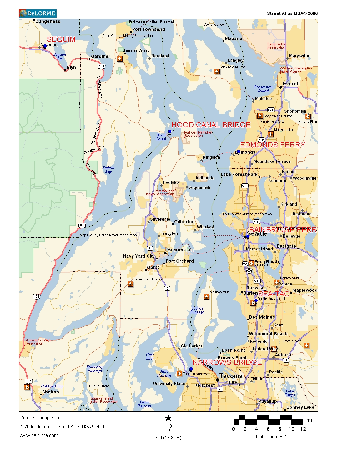
Here's the overview map showing Seattle and Sequim:
(follow down below map)
(Note: you can download any of these maps to your computer and print them.
For Windows computers, right click and "save as". They are standard .jpg images)
There are three basic ways to get from Seatac airport to Sequim. All three routes will take you to the Hood Canal Bridge, then on Highway 104 to Highway 101 to Sequim:
1. Take Interstate 5 South through Tacoma, Highway 16 across the Tacoma Narrows Bridge to around Bremerton, Highway 3 to the Hood Canal Bridge.
Click Here for maps and directions for this route.
This route is about 110 miles, but is sometimes faster than the ferry routes, because it is not dependent on ferry schedules. Also, no ferry charges.
2. Take Interstate 5 North into Seattle to the Bainbridge Island Ferry, across the water to Winslow, through Poulsbo, to the Hood Canal Bridge.
Click Here for maps and directions for this route.
This route is about 80 miles, and it is scenic and relaxing if the weather is good. But downtown traffic is sometimes a hassle. During the day, ferries leave about every 40 minutes and will cost about $20 for two people and a car.
3. Take Interstate 5 North through downtown Seattle to the Edmonds Ferry, across the water to Kingston, to the Hood Canal Bridge.
Click Here for maps and directions for this route.
This route is about 82 miles, and usually less crowded than the Bainbridge Island route. Unless it's rush hour, you can usually get through Seattle on I-5 fairly quickly. It's a nice ferry ride to Kingston, and from there, usually less than an hour to Sequim. Similar ferry schedule and rates to the Bainbridge Island ferry.